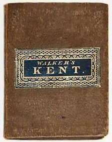
Walker’s [folding Map Of] Kent..
A very good example.
£65.00
Publisher
Printed by J. & C. Walker, n.d. but,
Date
c.1843.
Item Description
Hand-coloured engraved map, 16 x 13 inches. Dissected and mounted on linen folding into original cloth boards with the original label on the upper board and mileage chart on inner paste-down.
Notes
Nice example of this map of Kent with boundaries of the Lathes, Railways (such as there were at this date, South Eastern to Dover, and Canterbury and Whitstable) and parklands etc.
[Stock No. 15905]